St. Petersburg Metro Map
Interactive map · select start and end stations
Download metro map
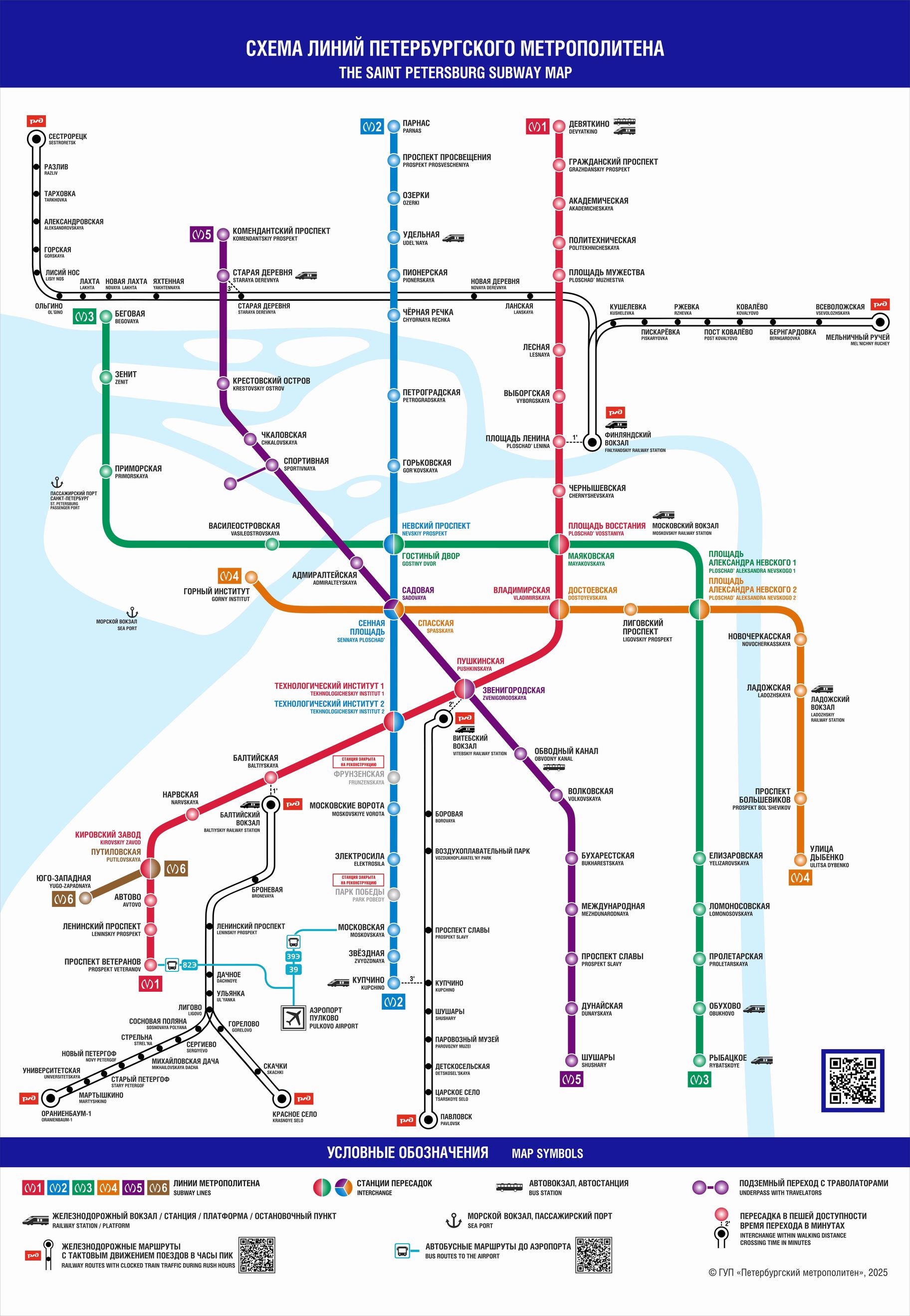
Official St. Petersburg Metro map, December 2025. All lines and 72 stations.
DownloadJPEG · 574 KB · 1824 × 2638 px
About St. Petersburg Metro
The St. Petersburg Metro is a rapid transit system serving St. Petersburg and the Leningrad Oblast. It opened on November 15, 1955, making it the second oldest and second largest metro in the post-Soviet space after Moscow.
The system consists of 5 lines with a total operational length of 124.8 km and 72 stations. There are 7 interchange hubs — 6 two-station and one three-station hub. 12 stations have connections to railway infrastructure (terminals, stations, and platforms).
The St. Petersburg Metro is the world's deepest by average station depth. Many stations have distinctive architectural and artistic designs, and 8 stations are listed as cultural heritage objects of Russia. A unique feature of the St. Petersburg Metro is its closed-type stations — with platform screen doors and no side platforms.